LA Reporter’s Aerial Video Shows Near-Entire Town Destroyed In SoCal Fires
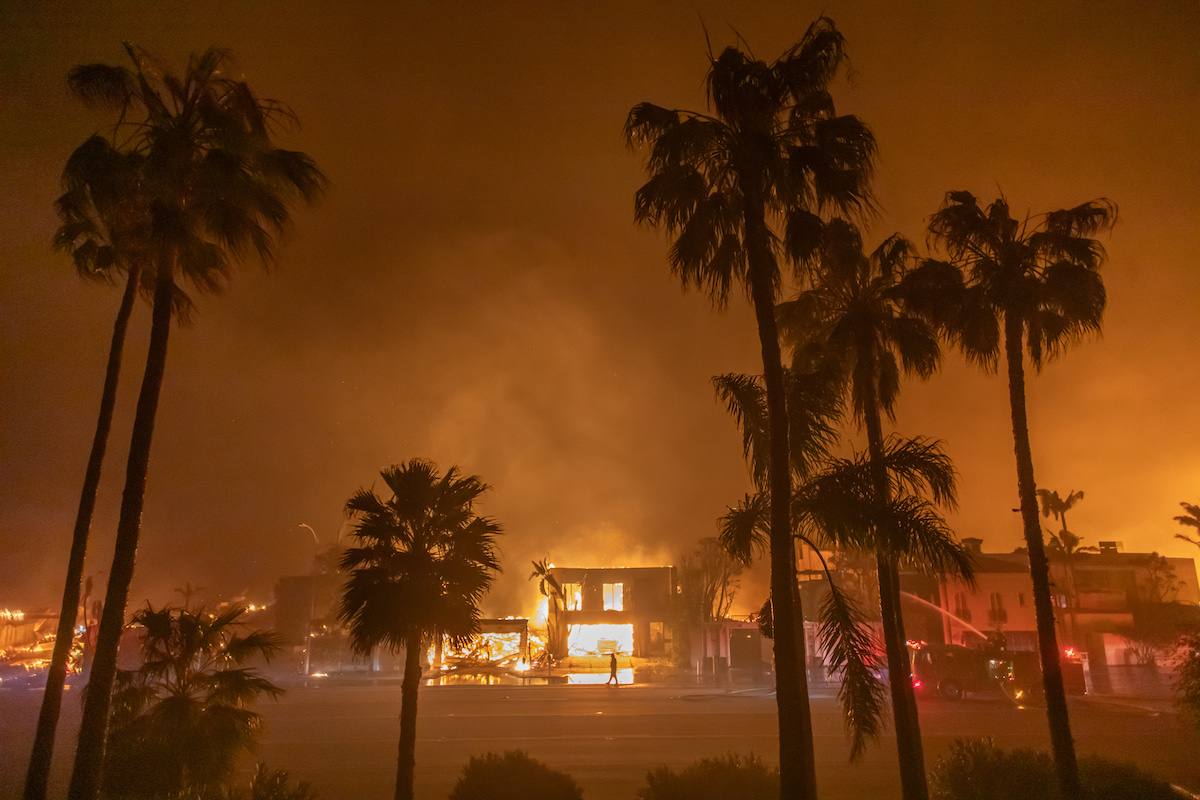
Los Angeles helicopter reporter Chris Cristi’s aerial video he posted on social media showed nearly an entire town in southern California destroyed in one of the multiple wildfires in Los Angeles.
In a clip posted on X that has since gone viral, the ABC7 reporter wrote that, “This is the closest aerial view I’ve been able to capture yet of almost the entire town of Altadena, CA. There are no words… #EatonFire.”
The video showed an overview of rows and rows of homes, as far as the eyes could see, in the town completely destroyed with little more than burnt palm trees left standing on each of the properties in a city of 42,000.
It is truly hard to estimate exactly how many lots shown on the video were wiped out in the San Gabriel Valley town, north of Pasadena.
THIS is the closest aerial view I’ve been able to capture yet of almost the entire town of Altadena, CA. There are no words… #EatonFire pic.twitter.com/uNX54XJUUL
— Chris Cristi (@abc7chriscristi) January 15, 2025
Three fires in the area — Palisades Fire, Eaton Fire, and Hurst Fire — quickly spread last week thanks to the high speed Santa Ana winds leading to the evacuations of tens of thousands. It has wiped out some 7,000 structures and burned up 14,000 acres in Altadena and Pasadena alone, KTLA reported.
As of Wednesday, officials said the fire is 45% contained, but they warn that they are still on high alert as more strong winds are expected in the area that has very dry conditions, CBS reported.
CELEBRATE #47 WITH 47% OFF DAILYWIRE+ MEMBERSHIPS + A FREE $20 GIFT
The Palisades fire has scorched some 23,000 acres and destroyed 10,000 structures, the outlet noted. A map from KTLA showed the homes destroyed. The ones completely wiped out are in red in the map that can be seen here.
“Today’s efforts are focused on mop up and reinforcing containment lines to ensure perimeter control,” an incident report from California Fire read. “Hazard trees along roadways are being mitigated to protect both firefighters and the public.”
“The fire is expected to remain within its current footprint, with aircraft continuing to support firefighters with retardant drops in inaccessible terrain,” it added. “As repopulation efforts progress, the focus remains on ensuring that people are brought back into a safe and secure environment. Contingency resources are strategically prepositioned and ready to respond throughout communities along the fire’s western edge to due to the Santa Ana wind conditions.”
Related: Anna Faris, Adam Brody, Mandy Moore Become Latest Celebs To Lose Homes In SoCal Fires
Originally Published at Daily Wire, Daily Signal, or The Blaze
What's Your Reaction?
 Like
0
 Dislike
0
 Love
0
 Funny
0
 Angry
0
 Sad
0
Sad
0
 Wow
0
Wow
0


